

For the last several years, PI Darrow has led a research team to fill data gaps in our current understanding of FDL-A in order to determine potential mitigation strategies.
Work has included: drilling on FDL-A, geophysics, laboratory testing of frozen samples, modeling, and ongoing monitoring of FDL movement rates.
Results from this research (funded by Alyeska Pipeline Service Company) will be coming soon!

To determine current movement rates
To characterize long-term movement of FDLs

To determine seasonal flow dynamics of FDLs

To determine movement and change detectionon multi-annual scale
To determine movement and change detection on annual scale
Abstract: The imminent collision of FDL-A with the abandoned section of embankment provides a unique opportunity to study a landslide impacting a roadway in a safe and controlled way and on a predictable schedule. The objective of this project is to obtain data from the collision of a landslide with an engineered structure in a full-scale field experiment.
We will achieve this objective by:

Drilling through the embankment at an instrument installation location (looking north down the abandoned Dalton Highway alignment).
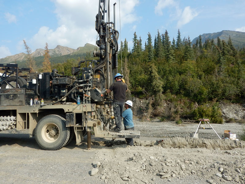
Looking east past the drill rig at the toe of FDL-A.
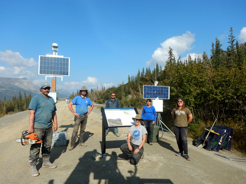
The UAF-DGGS-ADOT&PF research crew after completion of the drilling and instrument installation.
Abstract: This project is the first part of a multi-phase approach to measure the deformation of an engineered structure when impacted by a landslide. Frozen Debris Lobe A (FDL-A) is a slow-moving landslide in permafrost that will collide with the current alignment of the Dalton Highway, Alaska, by 2023. The overall outcome for all phases of this research will be protocol on how to plan for movement of these features to ensure long-term mobility along the highway.
LiDAR in a Backpack: This video provides an overview of our experience with a backpack-mounted LiDAR system, as related to frozen debris lobe research.

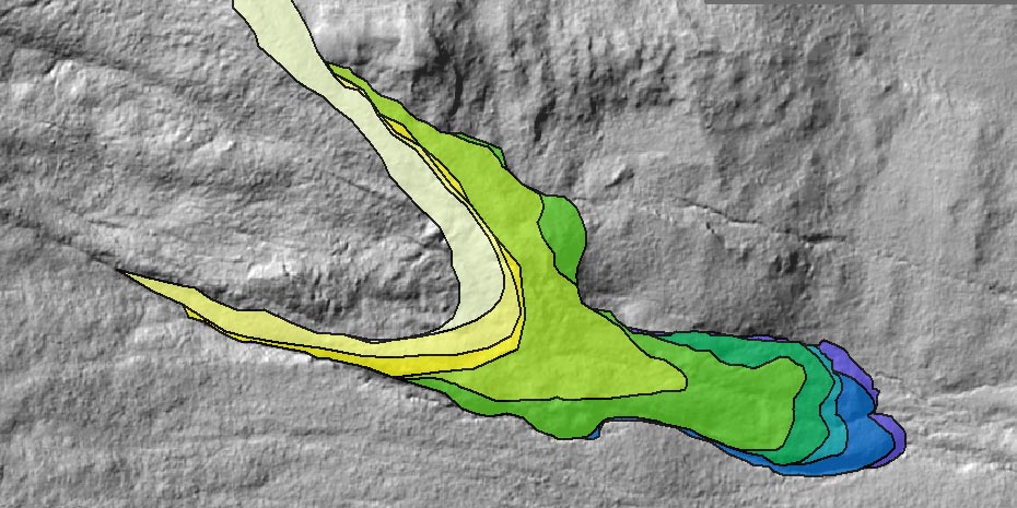
DEMs of Difference (DoD) for (a) yearly changes (July 2018 to August 2019), and (b) seasonal changes (June 2019 to August 2019). Background image is 2015 LiDAR.

Location of FDL-A relative to the old and new Dalton Highway embankments as of August 2, 2019. Background image is a combination of August 2018 LiDAR (0.1-m resolution) and 2015 LiDAR (1-m resolution).
Abstract: Frozen debris lobes (FDLs) are slow-moving landslides along permafrost-affected slopes. Within the Dalton Highway corridor in the southern Brooks Range, Alaska, the project identified 43 FDLs, with 23 occurring less than one mile uphill of the Dalton Highway. The closest FDL to the highway, FDL-A, was just over 136 ft away from the embankment when measured in August 2014. Should the rate of FDL-A increase to match those measured on other, faster-moving FDLs, it could cover the distance to the highway in about a year. When it does reach the highway, the project estimates it will place 60 tons of debris on the highway each day. This research project will employ remotely sensed data using multiple data acquisition methods to monitor and analyze FDLs at different temporal scales, thereby increasing the understanding of rates and episodes of movement of these potential geohazards. The project will evaluate each technique for its overall cost, ease of use, and applicability to assessing the flow dynamics of FDLs. The results produced from this study are critical for stakeholders to make informed future decisions regarding the infrastructure and mitigation strategies.
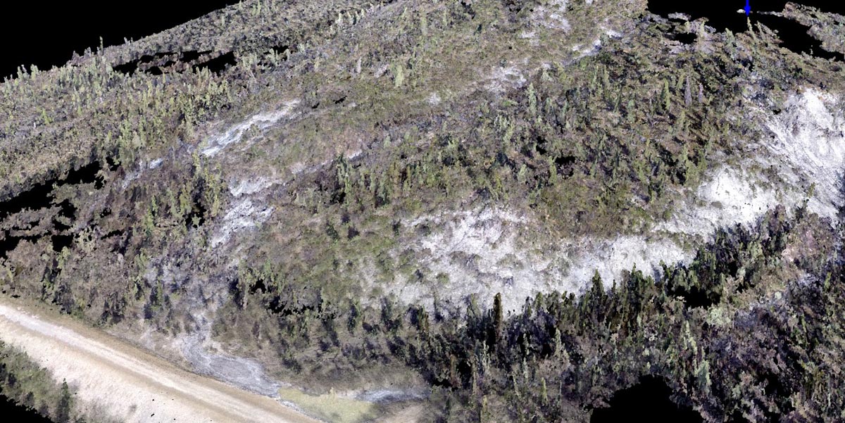
This short video provides a three-dimensional view of frozen debris lobes, using a digital elevation model of the area.
This video illustrates the historic movement of certain frozen debris lobes since 1955.